

Sensors
No wiring required. Continuously capture location, audio and environmental data for people, equipment, assets and places.
Sensor layer
Keep people, equipment, places and assets connected
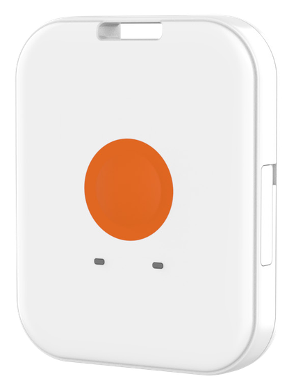
4G BeiDou positioning badge
Direct 4G reporting with seamless indoor and outdoor positioning
- 47gTotal weight, lightweight to wear
- 10mBeiDou / GPS positioning accuracy (CEP50)1
- IP67Dust and water protection; operating temperature −20 to 60 °C
- Approx. 1dayBattery life: alternating 8 h working and 16 h power saving2
- 1Satellite positioning accuracy is the nominal CEP50 value in an open area and is affected by weather, building obstructions and location. Lindos OS calculates indoor positions from 2.4 GHz beacon data.
- 2Battery life is tested with default settings: working mode locates and reports once per minute, with more frequent 2.4 GHz scans; power-saving mode scans, locates and reports once per hour. Alternating 8 hours working and 16 hours power saving gives about 1 day; power-saving mode alone gives about 4.5 days. Actual battery life varies by use case.
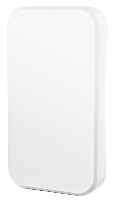
Helmet positioning tag
Attach to a safety helmet to keep personnel locations connected
- 6.7gTotal weight
- IP66Dust and water protection; ultrasonically sealed housing
- 3yearsBattery life with default broadcast settings1
- -20~60°COperating temperature
- 1Default broadcasts: location at 0 dBm every 10 s; status at −8 dBm every 5 s. Changing location broadcasts to every 5 s gives about 2 years. Values are nominal; actual battery life depends on temperature and broadcast settings.
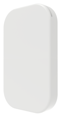
Connectable asset tag
Track the location and movement of equipment, returnable assets and facilities.
- 3yearsBattery life with default broadcast settings1
- 7.2mmHousing thickness; dimensions 56 × 34.5 mm
- 17gTotal weight
- 1sBroadcast interval after tamper detection2
- 1Default broadcasts: location at 0 dBm every 2 s; status at −8 dBm every 5 s; combined tamper frames at 0 dBm every 5 s. Values are nominal; actual performance depends on temperature and broadcast settings.
- 2When the tamper switch is triggered, combined frames broadcast every 1 s for 30 s, then stop.
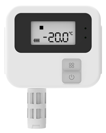
Long-range temperature and humidity sensor
Read locally on the LCD; receive reports when temperature limits are exceeded
- ±0.3°CTemperature accuracy from 0 to 30 °C1
- Approx. 1kmLine-of-sight range in an open area2
- 100,000 recordsOn-device data storage
- -30~70°CTemperature measurement range
- 1Temperature accuracy: ±0.3 °C from 0 to 30 °C; ±0.5 °C across the rest of the measurement range.
- 2Reference value for open, line-of-sight conditions at a maximum transmit power of 19 dBm. Actual coverage depends on antenna placement, obstructions, radio interference and network settings, and must be established by a site survey.
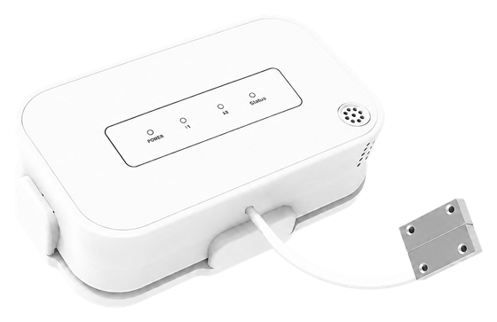
Wireless door sensor
An external magnetic probe reports door open/closed status over long distances
- 20mmMagnetic door detection distance
- 3yearsReference battery life with 10-minute reporting1
- -40~85°COperating temperature
- 128bitsAES data encryption
- 1Reference conditions: one report every 10 minutes, medium data rate and an ambient temperature of 25 °C. Actual battery life varies with the detection cycle, door activity and operating environment.
Network backbone
Reliably carry site signals upstream and commands downstream
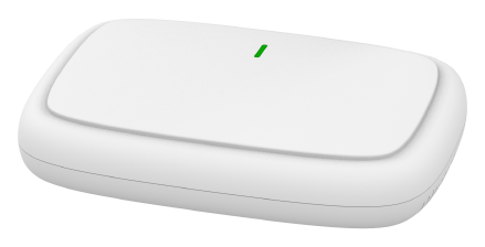
4G cloud bridge receiver
Connect to power; multiple uplinks keep site data connected
- Approx. 400records/sScanning capacity per radio module1
- 2.4WNormal operating power; peak 4.2 W2
- 3uplink typesAutomatic Ethernet / Wi-Fi / 4G failover3
- PoEPower over Ethernet (IEEE 802.3af) or 12 V DC
- 1Scanning capacity is per radio module: one scanning module is enabled by default, with multiple modules configurable. This is not the number of concurrently connected devices. Actual throughput depends on sensor broadcast settings, radio conditions and uplink capacity.
- 2Normal operating power is 2.4 W; peak consumption during multi-protocol communication and high-performance operation is 4.2 W.
- 3All networks must be configured before failover can operate. Priority is Ethernet, then Wi-Fi, then 4G. A 4G uplink requires a SIM card and mobile network coverage.
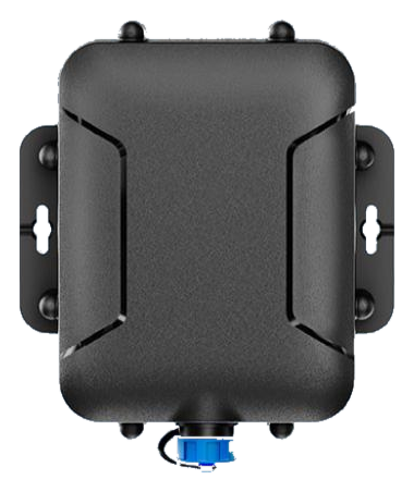
Outdoor mobile 4G receiver
Connect to vehicle power to keep assets visible in transit
- Approx. 100units2.4 GHz tags online simultaneously over a Cat.1 network1
- 8–52VWide-input-voltage DC vehicle power
- IP67Protection rating; IK10 impact resistance2
- 15mGNSS satellite positioning accuracy3
- 1About 100 simultaneous 2.4 GHz tags on a 4G Cat.1 network is a nominal value. Actual capacity depends on tag broadcast intervals, reporting cycles and network conditions; it is not a system concurrency guarantee.
- 2IP67 and IK10 are nominal protection ratings. The unit can be mounted outside the vehicle where needed to improve positioning and communication. Do not use it for extended periods above 60 °C.
- 3Positioning accuracy depends on installation and deployment conditions. For installation inside a vehicle, avoid metal obstructions in front of the unit to improve satellite reception.
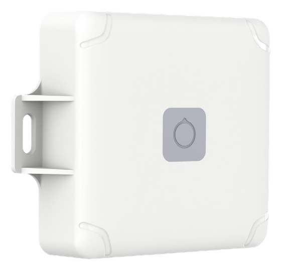
Relay positioning anchor
Relay, positioning anchor and beacon in one: battery powered, with no wiring
- 5.5yearsReference life at default settings; up to 10 years with infrequent scanning1
- 10.8AhReplaceable industrial lithium-thionyl chloride battery
- Up to 100unitsSensors forwarded by the relay2
- IP67Dust and water protection with no-wiring deployment
- 1Reference life assumes 25 °C ambient temperature, 0 dBm transmit power, a 2-second broadcast interval and a 1.2-second scan duration. Scanning every 30 seconds by default gives about 5.5 years; every minute about 8 years; every 2 minutes about 10 years. These estimates use laboratory power tests and theoretical calculations; actual life depends on environment, temperature and settings.
- 2Relay scanning forwards identification data for up to 100 sensors. Data exceeding one packet is automatically split across broadcast packets. This figure is not receiver capacity or system concurrency.
Specifications are nominal; test conditions are given in the footnotes. Product form and feature configuration depend on the project delivery. Detailed sensor and receiver specifications are available after an initial discussion.
Start with one site and one workflow
contact@lindos.cn
Deploy into your existing site without rewiring, alterations or interrupting operations. Tell us which workflow you want to improve first. Together, we will agree the available data, initial scope and measures of success.
Talk to us
Tell us about your site and the workflow you want to improve. We will arrange a conversation to agree how to get started.
contact@lindos.cn →02Request information
Explore solutions for your industry, the sensors involved and a practical starting scope.
contact@lindos.cn →03Partner with us
Develop and deliver a joint solution with clearly agreed roles and responsibilities.
contact@lindos.cn →